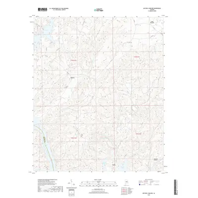
2018 Map of Mitchell Dam NW
USGS Topo · Published 2018About this map
Lay Lake and Mitchell Lake dominate the western edge of this Coosa County landscape, where the impounded Coosa River creates a complex shoreline of inlets and points. The terrain transitions from these broad waters into the elevations of the Weogufka Mountains to the southeast. Small, dispersed settlements like Gold Branch, Quinsey, and Dollar are connected by a network of county roads including Co Rd 55 and Co Rd 15. For those tracing local family history, the map identifies several burial grounds such as Duke Cem, Ham Lewis Cem, and Quinsey Cem. Numerous named tributaries, including Weogufka Creek, Clay Cr, and McSmith Br, carve through the ridges, illustrating the intricate drainage system feeding the central river valley.
Find a feature on this map
33 named features on this map. Tap any name to fly to it.
Don’t see what you’re looking for? This feature index may not catch every label — zoom into the map to look around manually.
Map Details
Editions of this 2018 Mitchell Dam NW Map
This is the sole edition of this map. No revisions or reprints were ever made.
Other maps of this area

1890 · Bessemer
USGS Topo · 1:125,000

1890 · Talladega
USGS Topo · 1:125,000

1891 · Clanton
USGS Topo · 1:125,000

1892 · Talladega
USGS Topo · 1:125,000

1892 · Bessemer
USGS Topo · 1:125,000

1901 · Wetumpka
USGS Topo · 1:125,000

1903 · Wetumpka
USGS Topo · 1:125,000

1909 · Columbiana
USGS Topo · 1:62,500

1911 · Columbiana
USGS Topo · 1:62,500

1915 · Gantts Quarry
USGS Topo · 1:48,000