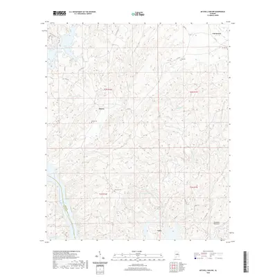
2020 Map of Mitchell Dam NW
USGS Topo · Published 2020About this map
Mitchell Lake and Lay Lake dominate the western edge of this Coosa County landscape, where the water meets a network of creeks and ridges. Small settlements like Dollar and Quinsey represent the quiet rural character of the region, connected by winding routes such as Co RD 55 and Little Tom RD. The terrain is defined by the Weogufka Mountains in the southeast, a significant topographic feature that influences the drainage of Weogufka Creek and None-less Cr. Local history is preserved through several family and community burial sites, including Quinsey Cem and the Ham Lewis Cem, while the Coosa Trail winds through the hills. This survey illustrates the balance between the hydroelectric reservoirs of the Coosa River system and the established upland communities during the early 21st century.
Find a feature on this map
35 named features on this map. Tap any name to fly to it.
Don’t see what you’re looking for? This feature index may not catch every label — zoom into the map to look around manually.
Map Details
Editions of this 2020 Mitchell Dam NW Map
This is the sole edition of this map. No revisions or reprints were ever made.
Other maps of this area

1890 · Bessemer
USGS Topo · 1:125,000

1890 · Talladega
USGS Topo · 1:125,000

1891 · Clanton
USGS Topo · 1:125,000

1892 · Talladega
USGS Topo · 1:125,000

1892 · Bessemer
USGS Topo · 1:125,000

1901 · Wetumpka
USGS Topo · 1:125,000

1903 · Wetumpka
USGS Topo · 1:125,000

1909 · Columbiana
USGS Topo · 1:62,500

1911 · Columbiana
USGS Topo · 1:62,500

1915 · Gantts Quarry
USGS Topo · 1:48,000