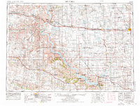
1955 Map of Mitchell
USGS Topo · Published 1976About this map
The Missouri River and the massive Lake Francis Case dominate this mid-century landscape, reflecting a transformative era for South Dakota hydrology and land use. This survey captures the region as the Fort Randall Dam had newly reshaped the valley, creating a vast reservoir that separates the plains of Lyman County from the eastern plateaus. The map details the complex boundaries of the Lower Brule Indian Reservation, Crow Creek Indian Reservation, Rosebud Indian Reservation, and Yankton Indian Reservation, providing a critical look at tribal lands and their relationship to the changing river. Along the Chicago Milwaukee St Paul and Pacific railroad, established settlements like Chamberlain, Plankinton, and Mitchell serve as regional hubs for agriculture and transport. Numerous recreation areas, such as Whetstone Bay St Rec Area and North Wheeler St Rec Area, signify the burgeoning post-dam tourism and conservation efforts centered around the newly created lake.
Find a feature on this map
110 named features on this map. Tap any name to fly to it.
Don’t see what you’re looking for? This feature index may not catch every label — zoom into the map to look around manually.
Map Details
Editions of this 1955 Mitchell Map
2 editions found

Other maps of this area

1898 · Olivet
USGS Topo · 1:125,000

1898 · Huron
USGS Topo · 1:125,000

1899 · Mitchell
USGS Topo · 1:125,000

1899 · Alexandria
USGS Topo · 1:125,000

1899 · De Smet
USGS Topo · 1:125,000

1935 · Chamberlain
USGS Topo · 1:62,500

1939 · Chamberlain
USGS Topo · 1:62,500

1940 · Iona
USGS Topo · 1:62,500

1941 · Pukwana
USGS Topo · 1:62,500

1941 · Kimball North
USGS Topo · 1:62,500