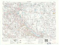
1959 Map of Mitchell
USGS Topo · Published 1959About this map
The Missouri River corridor dominates this mid-century landscape, showing the massive engineering impact of the Fort Randall Dam and the formation of Lake Francis Case. This survey captures a pivotal era of South Dakota water management and transport, with the Chicago Milwaukee St Paul and Pacific railroad cutting east-to-west through towns like Plankinton and Kimball. The geography is defined by the transition from the glaciated plains around Mitchell to the dramatic breaks and buttes of the west, including the Bijou Hills and Turtle Butte. Genealogists will find a dense network of townships across several counties, including Aurora and Davison, along with traditional sites like St. Marys Church and the historic Fort Lookout. The map also delineates the extensive boundaries of the Rosebud Indian Reservation and Yankton Indian Reservation, reflecting the complex cultural and political jurisdictions of the Missouri basin.
Find a feature on this map
97 named features on this map. Tap any name to fly to it.
Don’t see what you’re looking for? This feature index may not catch every label — zoom into the map to look around manually.
Map Details
Editions of this 1959 Mitchell Map
2 editions found

Other maps of this area

1898 · Olivet
USGS Topo · 1:125,000

1898 · Huron
USGS Topo · 1:125,000

1899 · Mitchell
USGS Topo · 1:125,000

1899 · Alexandria
USGS Topo · 1:125,000

1899 · De Smet
USGS Topo · 1:125,000

1935 · Chamberlain
USGS Topo · 1:62,500

1939 · Chamberlain
USGS Topo · 1:62,500

1940 · Iona
USGS Topo · 1:62,500

1941 · Pukwana
USGS Topo · 1:62,500

1941 · Kimball North
USGS Topo · 1:62,500