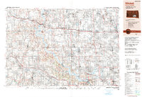
1990 Map of Mitchell
USGS Topo · Published 1991About this map
Mitchell serves as the regional anchor on this landscape where the James River and Firesteel Creek meet the vast agricultural plains. The 1990 survey captures the geographic dominance of the Missouri River, significantly transformed by the Fort Randall Dam which created the expansive Lake Francis Case. This waterway acts as a massive boundary between the rolling terrain of the Bijou Hills and Iona Hills to the west and the strictly gridded farmland to the east.
Find a feature on this map
128 named features on this map. Tap any name to fly to it.
Don’t see what you’re looking for? This feature index may not catch every label — zoom into the map to look around manually.
Map Details
Editions of this 1990 Mitchell Map
This is the sole edition of this map. No revisions or reprints were ever made.
Other maps of this area

1898 · Olivet
USGS Topo · 1:125,000

1898 · Huron
USGS Topo · 1:125,000

1899 · Mitchell
USGS Topo · 1:125,000

1899 · Alexandria
USGS Topo · 1:125,000

1899 · De Smet
USGS Topo · 1:125,000

1935 · Chamberlain
USGS Topo · 1:62,500

1939 · Chamberlain
USGS Topo · 1:62,500

1940 · Iona
USGS Topo · 1:62,500

1941 · Pukwana
USGS Topo · 1:62,500

1941 · Kimball North
USGS Topo · 1:62,500