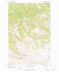
1962 Map of Mitchell Mountain
USGS Topo · Published 1975About this map
Hilger Valley and the surrounding high country in Lewis and Clark Co provide a look at the ranching and transportation corridors of the early 1960s. The eastern edge of the map follows the Great Northern rail line and Little Prickly Pear Creek, a vital passage through the mountains near the small settlement of Sieben. This area is dominated by the sprawling Sieben Ranch, illustrating the large-scale livestock operations that have long defined the region's economy.
Find a feature on this map
24 named features on this map. Tap any name to fly to it.
Don’t see what you’re looking for? This feature index may not catch every label — zoom into the map to look around manually.
Map Details
Editions of this 1962 Mitchell Mountain Map
2 editions found
Other maps of this area

1889 · Helena
USGS Topo · 1:250,000

1893 · Helena
USGS Topo · 1:250,000

1899 · Helena
USGS Topo · 1:250,000

1903 · Helena
USGS Topo · 1:250,000

1943 · Hogan
USGS Topo · 1:125,000

1947 · Butte
USGS Topo · 1:250,000

1955 · Choteau
USGS Topo · 1:250,000

1957 · Choteau
USGS Topo · 1:250,000

1958 · Butte
USGS Topo · 1:250,000

1958 · Choteau
USGS Topo · 1:250,000