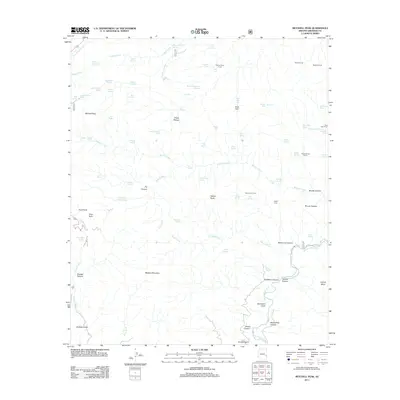
2011 Map of Mitchell Peak
USGS Topo · Published 2011About this map
Mitchell Peak rises as the dominant landmark of this high-country landscape in eastern Arizona, where the geography is defined by a dense network of water sources and stock management infrastructure. The terrain reveals a complex system of drainage and ranching history, illustrated by numerous family-named and descriptive springs such as Don Smith Spring, McBride Spring, and Lower Sardine Spring. This map reflects the essential nature of water in the high desert, documenting dozens of tanks and corrals like the Saddle Corral and Dam Tank used for livestock.
Find a feature on this map
82 named features on this map. Tap any name to fly to it.
Don’t see what you’re looking for? This feature index may not catch every label — zoom into the map to look around manually.
Map Details
Editions of this 2011 Mitchell Peak Map
This is the sole edition of this map. No revisions or reprints were ever made.
Other maps of this area

1902 · Clifton
USGS Topo · 1:62,500

1913 · Morenci
USGS Topo · 1:125,000

1915 · Morenci
USGS Topo · 1:125,000

1954 · Clifton
USGS Topo · 1:250,000

1957 · Clifton
USGS Topo · 1:250,000

1958 · Clifton
USGS Topo · 1:250,000

1962 · Clifton
USGS Topo · 1:250,000

1962 · Clifton
USGS Topo · 1:62,500

1962 · Big Lue Mts
USGS Topo · 1:62,500
1967 · Bee Canyon
USGS Topo · 1:24,000