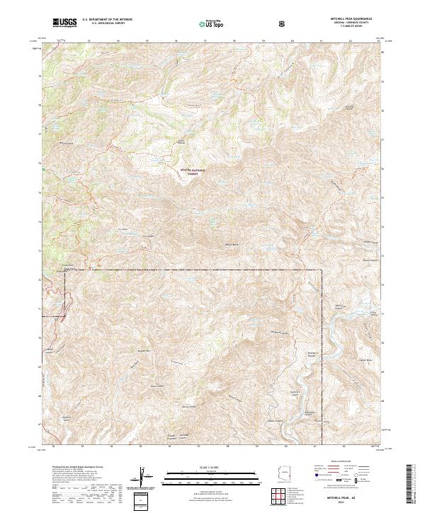
2021 Map of Mitchell Peak
USGS Topo · Published 2021About this map
Apache National Forest defines the rugged verticality of this Greenlee County landscape, where deep drainages like Pigeon Canyon and Woods Canyon slice through the high country. Rising above the complex network of trails and springs is Mitchell Peak, a prominent landmark for early travelers and forest rangers alike. The map reveals a history of land use etched into the terrain, from the legacy of mineral exploration evidenced by names like Placer Gulch and Copper King Mtn to the essential water sources scattered across the dry heights, such as Don Smith Spring and Roughout Spring. Extensive trail systems including the Coronado Trl and Pigeon Trl connect these remote points, providing a detailed look at the backcountry infrastructure maintained within the forest's boundaries.
Find a feature on this map
97 named features on this map. Tap any name to fly to it.
Don’t see what you’re looking for? This feature index may not catch every label — zoom into the map to look around manually.
Map Details
Editions of this 2021 Mitchell Peak Map
This is the sole edition of this map. No revisions or reprints were ever made.
Other maps of this area

1902 · Clifton
USGS Topo · 1:62,500

1913 · Morenci
USGS Topo · 1:125,000

1915 · Morenci
USGS Topo · 1:125,000

1954 · Clifton
USGS Topo · 1:250,000

1957 · Clifton
USGS Topo · 1:250,000

1958 · Clifton
USGS Topo · 1:250,000

1962 · Clifton
USGS Topo · 1:250,000

1962 · Clifton
USGS Topo · 1:62,500

1962 · Big Lue Mts
USGS Topo · 1:62,500
1967 · Bee Canyon
USGS Topo · 1:24,000