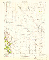
1948 Map of Mitchell School
USGS Topo · Published 1948About this map
Agricultural development along the Stanislaus and Merced county border is defined by a dense grid of irrigation canals and schoolhouses in the late 1940s. The landscape is structured by an extensive network of laterals, including Lateral No 6 and the Stevinson Upper Lateral, which fed the region's farms. Settlement is concentrated around small hubs like Hatch and the industrial site at Chemurgic, while the education of the rural population was supported by numerous local institutions such as Mountain View Sch, Washington Sch, and Prairie Flower Sch. To the southwest, the wandering course of the San Joaquin River and the wetlands of Orestimba create a sharp contrast to the geometric precision of the inland roads. The Southern Pacific Railroad cuts diagonally across this landscape, connecting these Central Valley farming communities to broader markets.
Find a feature on this map
66 named features on this map. Tap any name to fly to it.
Don’t see what you’re looking for? This feature index may not catch every label — zoom into the map to look around manually.
Map Details
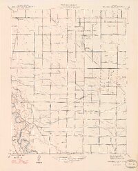
Editions of this 1948 Mitchell School Map
2 editions found
Other maps of this area

1915 · Westport
USGS Topo · 1:31,680

1916 · Mitchell School
USGS Topo · 1:31,680

1916 · Crows Landing
USGS Topo · 1:31,680

1916 · Denair
USGS Topo · 1:31,680

1916 · Ceres
USGS Topo · 1:31,680

1917 · Turlock
USGS Topo · 1:31,680

1917 · Newman
USGS Topo · 1:31,680

1918 · Stevinson
USGS Topo · 1:31,680

1918 · Gustine
USGS Topo · 1:31,680

1919 · Orestimba
USGS Topo · 1:62,500