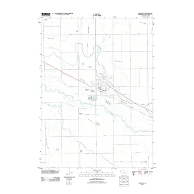
2011 Map of Mitchell
USGS Topo · Published 2011About this map
Mitchell serves as the central hub of this North Platte Valley landscape, where an intricate network of irrigation canals supports the region's agricultural vitality. The North Platte River winds through the center of the sheet, flanked by a series of engineered waterways including the Tri-State Canal, Enterprise Canal, and the Mitchell and Gering Canal. This reliance on water management is evident in the dense grid of rural roads and laterals, such as Lateral 21 Main, which reach out to outlying communities like Pelton, Jane, and Haig.
Find a feature on this map
58 named features on this map. Tap any name to fly to it.
Don’t see what you’re looking for? This feature index may not catch every label — zoom into the map to look around manually.
Map Details
Editions of this 2011 Mitchell Map
This is the sole edition of this map. No revisions or reprints were ever made.
Other maps of this area

1898 · Scotts Bluff
USGS Topo · 1:125,000

1899 · Whistle Creek
USGS Topo · 1:125,000

1954 · Scottsbluff
USGS Topo · 1:250,000

1955 · Alliance
USGS Topo · 1:250,000

1957 · Alliance
USGS Topo · 1:250,000

1958 · Alliance
USGS Topo · 1:250,000

1958 · Scottsbluff
USGS Topo · 1:250,000

1960 · Stegall
USGS Topo · 1:24,000

1963 · Scottsbluff South
USGS Topo · 1:24,000

1963 · Mitchell
USGS Topo · 1:24,000