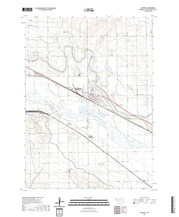
2021 Map of Mitchell
USGS Topo · Published 2021About this map
The North Platte River defines the landscape of this Scotts Bluff County region, anchoring an intricate network of irrigation systems essential to the local agricultural economy. The city of Mitchell serves as the central hub, characterized by a grid of streets including Broadway St and Railway St, reflecting its historical development along the rail line. Surrounding the town, a complex series of waterways like the Tri-State Canal, Enterprise Canal, and Mitchell Land Gering Canal demonstrate the intensive land management required in the Nebraska panhandle. Smaller settlements and named locales such as South Mitchell, Pelton, and Haig are connected by a system of rural roads like Experiment Farm Rd and Cook Oil Rd. For those tracing family history, the map identifies local burial grounds including Mitchell Cem and Mitchell Valley Cem, alongside geographic features like Lewis Lake and the formations of Browns Canyon.
Find a feature on this map
72 named features on this map. Tap any name to fly to it.
Don’t see what you’re looking for? This feature index may not catch every label — zoom into the map to look around manually.
Map Details
Editions of this 2021 Mitchell Map
This is the sole edition of this map. No revisions or reprints were ever made.
Other maps of this area

1898 · Scotts Bluff
USGS Topo · 1:125,000

1899 · Whistle Creek
USGS Topo · 1:125,000

1954 · Scottsbluff
USGS Topo · 1:250,000

1955 · Alliance
USGS Topo · 1:250,000

1957 · Alliance
USGS Topo · 1:250,000

1958 · Alliance
USGS Topo · 1:250,000

1958 · Scottsbluff
USGS Topo · 1:250,000

1960 · Stegall
USGS Topo · 1:24,000

1963 · Scottsbluff South
USGS Topo · 1:24,000

1963 · Mitchell
USGS Topo · 1:24,000