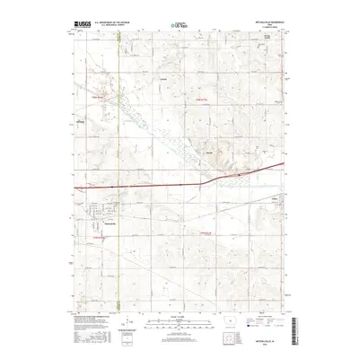
2015 Map of Mitchellville
USGS Topo · Published 2015About this map
Polk and Jasper counties meet along a north-south line that divides this rural landscape, where the South Skunk River carves a path through central Iowa. The river valley is a defining physical corridor, evidenced by the Old Channel and several tributaries like Sugar Cr and Santiago Cr. The settlement of Mitchellville sits in the southwestern quadrant, displaying a grid of streets such as Mill St SE and Center Ave N. To the northeast, the terrain rises toward Green Castle, a distinct high point overlooking the surrounding farmland.
Find a feature on this map
65 named features on this map. Tap any name to fly to it.
Don’t see what you’re looking for? This feature index may not catch every label — zoom into the map to look around manually.
Map Details
Editions of this 2015 Mitchellville Map
This is the sole edition of this map. No revisions or reprints were ever made.
Other maps of this area

1930 · Mitchellville
USGS Topo · 1:62,500

1954 · Des Moines
USGS Topo · 1:250,000

1956 · Des Moines
USGS Topo · 1:250,000

1957 · Des Moines
USGS Topo · 1:250,000

1965 · Prairie City
USGS Topo · 1:24,000

1965 · Colfax
USGS Topo · 1:24,000

1969 · Des Moines
USGS Topo · 1:250,000
1972 · Runnells
USGS Topo · 1:24,000
1972 · Altoona
USGS Topo · 1:24,000
1972 · Rising Sun
USGS Topo · 1:24,000