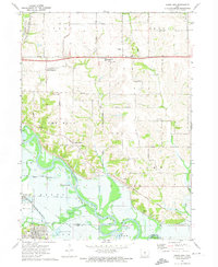
1972 Map of Rising Sun
USGS Topo · Published 1974About this map
The Des Moines River winds through the southeastern portion of this landscape, marking the border between Polk and Warren counties near Carlisle. This early 1970s survey captures a transition from rural townships like Four Mile and Camp toward suburban expansion in Woodland Hills. Small settlements such as Rising Sun and Adelphi remain distinct, connected by the Vandalia Road and the path of the Norfolk and Western Railroad.
Find a feature on this map
65 named features on this map. Tap any name to fly to it.
Don’t see what you’re looking for? This feature index may not catch every label — zoom into the map to look around manually.
Map Details
Editions of this 1972 Rising Sun Map
This is the sole edition of this map. No revisions or reprints were ever made.
Other maps of this area

1905 · Des Moines
USGS Topo · 1:62,500

1907 · Des Moines
USGS Topo · 1:62,500

1910 · Milo
USGS Topo · 1:62,500

1930 · Mitchellville
USGS Topo · 1:62,500

1931 · Indianola
USGS Topo · 1:62,500

1954 · Des Moines
USGS Topo · 1:250,000

1956 · Des Moines
USGS Topo · 1:250,000

1956 · Des Moines SE
USGS Topo · 1:24,000

1956 · Des Moines NE
USGS Topo · 1:24,000

1956 · Des Moines
USGS Topo · 1:62,500