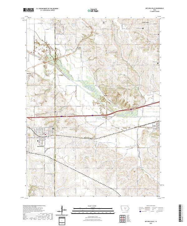
2023 Map of Mitchellville
USGS Topo · Published 2023About this map
Mitchellville and Valeria anchor this portion of the Iowa landscape where the modern Chichaqua Valley Trl follows the old rail corridors through the heart of the South Skunk River valley. The map documents a rural transition where the agrarian grid of Polk and Jasper counties meets the winding path of the river, which features an Old Channel segment southeast of Oswalt. Local history and genealogy are well-represented by a cluster of family and community burial sites, including Sams Cem, Fisher Cem, and McKeever Cem. While Colfax appears on the eastern margin, the interior is defined by smaller communities like Santiago and the sprawling network of county roads such as Co Rd F34 and Co Hwy F48. The mapping of modern property boundaries and wetlands by the U.S. Geological Survey provides a clear view of how these historic settlements integrate with contemporary infrastructure and water systems like Sugar Creek and Red Rock Creek.
Find a feature on this map
50 named features on this map. Tap any name to fly to it.
Don’t see what you’re looking for? This feature index may not catch every label — zoom into the map to look around manually.
Map Details
Editions of this 2023 Mitchellville Map
This is the sole edition of this map. No revisions or reprints were ever made.
Other maps of this area

1930 · Mitchellville
USGS Topo · 1:62,500

1954 · Des Moines
USGS Topo · 1:250,000

1956 · Des Moines
USGS Topo · 1:250,000

1957 · Des Moines
USGS Topo · 1:250,000

1965 · Prairie City
USGS Topo · 1:24,000

1965 · Colfax
USGS Topo · 1:24,000

1969 · Des Moines
USGS Topo · 1:250,000
1972 · Runnells
USGS Topo · 1:24,000
1972 · Altoona
USGS Topo · 1:24,000
1972 · Rising Sun
USGS Topo · 1:24,000