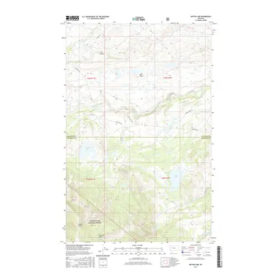
2017 Map of Mitten Lake
USGS Topo · Published 2017About this map
Lewis & Clark National Forest encompasses the southern portion of this landscape, where the terrain rises toward Lookout Ridge and the Mowitch Basin. This area of the Rocky Mountain Front is defined by its drainage systems, with the waters of Badger Creek and Little Badger Cr carving through the northern sections while the N Fork Whitetail Cr and S Fork Whitetail Cr dominate the south. The map documents a network of primitive access routes, including the Oil Well Trl, Running Crane Trl, and Spotted Eagle Trl, which connect the high ridges to the surrounding coulees. Notable landmarks like Mitten Lake, Horn Lake, and Twin Lakes are situated across the transition from the high forest into the open basins of Hay Coulee and Bite Coulee.
Find a feature on this map
23 named features on this map. Tap any name to fly to it.
Don’t see what you’re looking for? This feature index may not catch every label — zoom into the map to look around manually.
Map Details
Editions of this 2017 Mitten Lake Map
This is the sole edition of this map. No revisions or reprints were ever made.
Other maps of this area

1913 · Marias Pass
USGS Topo · 1:125,000

1914 · Heart Butte
USGS Topo · 1:125,000

1918 · Heart Butte
USGS Topo · 1:125,000

1960 · Cut Bank
USGS Topo · 1:250,000

1963 · Cut Bank
USGS Topo · 1:250,000

1964 · Cut Bank
USGS Topo · 1:250,000

1968 · Half Dome Crag
USGS Topo · 1:24,000

1968 · Swift Reservoir
USGS Topo · 1:24,000

1968 · Fish Lake
USGS Topo · 1:24,000

1968 · White Man Coulee
USGS Topo · 1:24,000