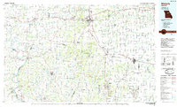
1985 Map of Moberly
USGS Topo · Published 1985About this map
The Missouri River serves as the southwestern anchor for this 1980s landscape, where the Norfolk and Western RR and Missouri-Kansas-Texas RR create a distinct industrial grid across the rolling plains of Randolph and Howard Counties. Moberly and Fayette emerge as central hubs for commerce and transport, while smaller communities like Clifton Hill, Renick, and Higbee are linked by a network of state routes including Mo 5 and Mo 240.
Find a feature on this map
142 named features on this map. Tap any name to fly to it.
Don’t see what you’re looking for? This feature index may not catch every label — zoom into the map to look around manually.
Map Details
Editions of this 1985 Moberly Map
2 editions found
Other maps of this area

1886 · Jefferson City
USGS Topo · 1:125,000

1887 · Sedalia
USGS Topo · 1:125,000

1888 · Boonville
USGS Topo · 1:125,000

1890 · Mexico
USGS Topo · 1:125,000

1890 · Moberly
USGS Topo · 1:125,000

1890 · Glasgow
USGS Topo · 1:125,000

1890 · Fulton
USGS Topo · 1:125,000

1890 · Marshall
USGS Topo · 1:125,000

1892 · Marshall
USGS Topo · 1:125,000

1894 · Sedalia
USGS Topo · 1:125,000