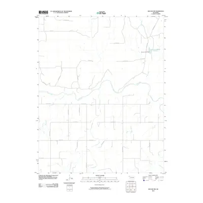
2010 Map of Mocane SW
USGS Topo · Published 2010About this map
The Beaver River winds through this section of Beaver County, serving as the primary drainage for an arid landscape defined by numerous named hollows and ephemeral tributaries. This 2010 topographic record highlights a highly organized sectional road grid, dominated by thoroughfares such as Beaver Rd and a network of numeric section line roads like Hollow N1410 and Hollow E0150.
Find a feature on this map
31 named features on this map. Tap any name to fly to it.
Don’t see what you’re looking for? This feature index may not catch every label — zoom into the map to look around manually.
Map Details
Editions of this 2010 Mocane SW Map
This is the sole edition of this map. No revisions or reprints were ever made.
Other maps of this area

1954 · Perryton
USGS Topo · 1:250,000

1958 · Perryton
USGS Topo · 1:250,000

1970 · Mocane NW
USGS Topo · 1:24,000

1970 · Mocane SE
USGS Topo · 1:24,000
1970 · Mocane
USGS Topo · 1:24,000

1971 · Clear Lake NW
USGS Topo · 1:24,000

1971 · Clear Lake
USGS Topo · 1:24,000
1971 · Mocane SW
USGS Topo · 1:24,000

1973 · Balko NE
USGS Topo · 1:24,000
1973 · Forgan
USGS Topo · 1:24,000