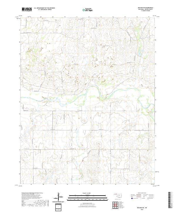
2022 Map of Mocane SW
USGS Topo · Published 2022About this map
The Beaver River winds through this section of the Oklahoma Panhandle, carving a wide valley floor characterized by shifting sand and intermittent water. The surrounding landscape is defined by a dense network of drainage features, many labeled with unique numerical identifiers such as Hollow N1418 and Hollow E0140. These features illustrate the complex erosional patterns of the High Plains, where seasonal runoff from these hollows feeds into larger tributaries like Spring Cr and Timber Cr.
Find a feature on this map
46 named features on this map. Tap any name to fly to it.
Don’t see what you’re looking for? This feature index may not catch every label — zoom into the map to look around manually.
Map Details
Editions of this 2022 Mocane SW Map
This is the sole edition of this map. No revisions or reprints were ever made.
Other maps of this area

1954 · Perryton
USGS Topo · 1:250,000

1958 · Perryton
USGS Topo · 1:250,000

1970 · Mocane NW
USGS Topo · 1:24,000

1970 · Mocane SE
USGS Topo · 1:24,000
1970 · Mocane
USGS Topo · 1:24,000

1971 · Clear Lake NW
USGS Topo · 1:24,000

1971 · Clear Lake
USGS Topo · 1:24,000
1971 · Mocane SW
USGS Topo · 1:24,000

1973 · Balko NE
USGS Topo · 1:24,000
1973 · Forgan
USGS Topo · 1:24,000