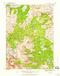
1937 Map of Moccasin Lake
USGS Topo · Published 1958About this map
The Continental Divide defines the western edge of this 1930s survey, marking a high-elevation alpine landscape where water flows toward the Pacific and Atlantic basins. Spanning the Wind River Indian Reservation, Shoshone National Forest, and Bridger National Forest, the map captures a remote wilderness of significant importance to the Eastern Shoshone and Northern Arapaho.
Find a feature on this map
84 named features on this map. Tap any name to fly to it.
Don’t see what you’re looking for? This feature index may not catch every label — zoom into the map to look around manually.
Map Details
Editions of this 1937 Moccasin Lake Map
5 editions found
Other maps of this area

1937 · Moccasin Lake
USGS Topo · 1:48,000

1938 · Mt Bonneville
USGS Topo · 1:62,500

1941 · Mt Bonneville
USGS Topo · 1:62,500

1942 · Mt Bonneville
USGS Topo · 1:62,500

1943 · Moccasin Lake
USGS Topo · 1:62,500

1951 · Fort Washakie
USGS Topo · 1:24,000

1952 · Wise Flat
USGS Topo · 1:24,000

1952 · Wind River
USGS Topo · 1:24,000

1952 · Paradise Basin
USGS Topo · 1:24,000

1952 · St. Lawrence Basin
USGS Topo · 1:24,000