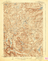
1943 Map of Moccasin Lake
USGS Topo · Published 1943About this map
The Continental Divide forms a natural boundary along the southwestern edge of this Wyoming landscape, defining a high-altitude wilderness where the Wind River Indian Reservation meets the Washakie National Forest. Surveyed in the late 1930s, the terrain is characterized by a dense network of glacial lakes and high peaks, including Mt Chauvenet and Bears Ears Mtn. Human presence is marked by remote outposts like the Ranger Station in Washakie Park and the North Fork Guard Sta near Sand Creek. The Washakie Trail provides a critical historical route through the mountains, connecting the reservation lands to the alpine basins. Water resources are central to the area's geography, from the Washakie Reservoir in the northeast to the South Fork Little Wind River, which drains the vast southern watersheds near Lizard Head Meadows.
Find a feature on this map
72 named features on this map. Tap any name to fly to it.
Don’t see what you’re looking for? This feature index may not catch every label — zoom into the map to look around manually.
Map Details
Editions of this 1943 Moccasin Lake Map
2 editions found
Other maps of this area

1937 · Moccasin Lake
USGS Topo · 1:48,000

1938 · Mt Bonneville
USGS Topo · 1:62,500

1941 · Mt Bonneville
USGS Topo · 1:62,500

1942 · Mt Bonneville
USGS Topo · 1:62,500

1943 · Moccasin Lake
USGS Topo · 1:62,500

1951 · Fort Washakie
USGS Topo · 1:24,000

1952 · Wise Flat
USGS Topo · 1:24,000

1952 · Wind River
USGS Topo · 1:24,000

1952 · Paradise Basin
USGS Topo · 1:24,000

1952 · St. Lawrence Basin
USGS Topo · 1:24,000