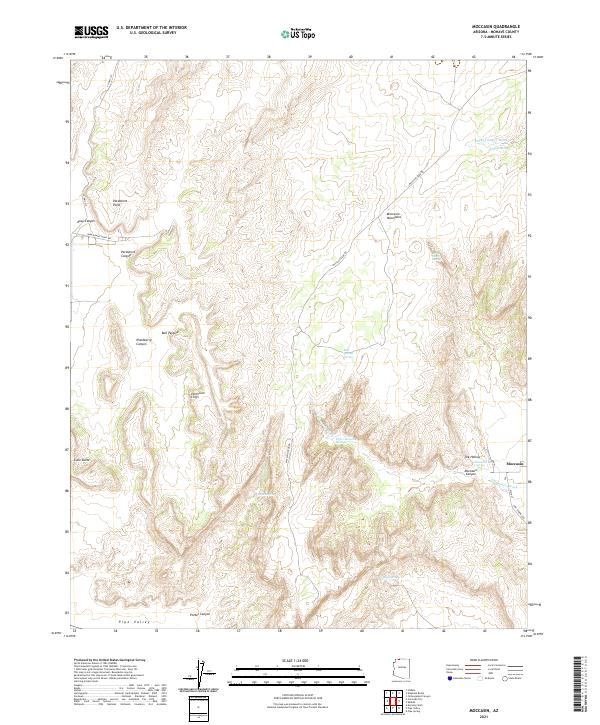
2021 Map of Moccasin
USGS Topo · Published 2021About this map
The high desert landscape of Moccasin is defined by its vital water sources and dramatic elevation changes along the Vermilion Cliffs. This corner of Mohave County reveals a reliance on isolated water points like Moccasin Spring and Bull Pasture Spring, which historically supported ranching and small-scale settlement in an otherwise arid environment. The map shows a clear transition from the low-lying Pipe Valley in the south up through the steep terrain of Moccasin Canyon toward the northern ridges of the Moccasin Mountains. Local geography is marked by distinctive landmarks such as Parashont Point and Lone Butte, while the drainage of Sandy Canyon Wash cuts through the high plateau. The road network, including Pipe Springs Rd and Maccasin Peak Rd, traces the accessible routes between these springs and canyons, illustrating the enduring relationship between the topography and the limited paths available for travel.
Find a feature on this map
33 named features on this map. Tap any name to fly to it.
Don’t see what you’re looking for? This feature index may not catch every label — zoom into the map to look around manually.
Map Details
Editions of this 2021 Moccasin Map
This is the sole edition of this map. No revisions or reprints were ever made.
Other maps of this area

1886 · Kanab
USGS Topo · 1:250,000

1886 · Kaibab
USGS Topo · 1:250,000

1953 · Cedar City
USGS Topo · 1:250,000

1953 · Grand Canyon
USGS Topo · 1:250,000

1954 · Kanab SW
USGS Topo · 1:24,000
1954 · Short Creek SW
USGS Topo · 1:24,000

1954 · Fredonia NW
USGS Topo · 1:24,000

1954 · Short Creek SE
USGS Topo · 1:24,000
1954 · Short Creek NW
USGS Topo · 1:24,000

1954 · Fredonia SW
USGS Topo · 1:24,000