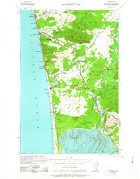
1938 Map of Moclips
USGS Topo · Published 1963About this map
The Aloha Logging Company Mill and the Northern Pacific railroad infrastructure define the industrial character of this coastal Grays Harbor landscape just before the Second World War. The map details a transition from the dense timberlands of the Quinault Indian Reservation in the north to the tidal flats of North Bay in the south. Along the Pacific shoreline, a string of seaside communities including Moclips, Pacific Beach, and Copalis Beach are linked by coastal roads and rail spurs, serving as both recreational destinations and shipment points for the region's timber. The inland terrain is marked by the winding courses of the Humptulips River and Copalis River, which carve through the wooded uplands past landmarks like Saddle Hill and Langley Hill. Small settlements such as Carlisle and Stearnsville highlight the era's scattered labor and residential patterns centered around the local logging and milling operations.
Find a feature on this map
54 named features on this map. Tap any name to fly to it.
Don’t see what you’re looking for? This feature index may not catch every label — zoom into the map to look around manually.
Map Details
Editions of this 1938 Moclips Map
2 editions found
Other maps of this area

1921 · Quinault Lake
USGS Topo · 1:62,500

1938 · Moclips
USGS Topo · 1:62,500

1941 · Moclips
USGS Topo · 1:62,500

1941 · Grayland
USGS Topo · 1:62,500

1943 · Humptulips
USGS Topo · 1:62,500

1943 · Copalis Beach
USGS Topo · 1:250,000

1951 · Copalis Beach
USGS Topo · 1:250,000

1953 · Hoquiam
USGS Topo · 1:250,000

1955 · Taholah
USGS Topo · 1:62,500

1955 · Macafee Hill
USGS Topo · 1:62,500