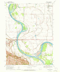
1970 Map of Modale
USGS Topo · Published 1972About this map
The Missouri River defines this landscape along the Iowa Nebraska border, winding through a complex system of active channels and former riverbeds. The sharp curve at California Bend and the crescent of De Soto Lake—remnant of the De Soto Cutoff—illustrate the river's dynamic history. These waterways anchor extensive conservation areas, including the De Soto National Wildlife Refuge and the Tyson Island State Wildlife Management Area.
Find a feature on this map
36 named features on this map. Tap any name to fly to it.
Don’t see what you’re looking for? This feature index may not catch every label — zoom into the map to look around manually.
Map Details
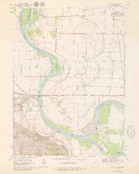
Editions of this 1970 Modale Map
2 editions found
Other maps of this area

1893 · Omaha
USGS Topo · 1:62,500

1893 · Fremont
USGS Topo · 1:125,000

1896 · Fremont
USGS Topo · 1:125,000

1954 · Omaha
USGS Topo · 1:250,000

1955 · Fremont
USGS Topo · 1:250,000

1957 · Fremont
USGS Topo · 1:250,000

1957 · Omaha
USGS Topo · 1:250,000

1957 · Loveland
USGS Topo · 1:24,000

1958 · Omaha
USGS Topo · 1:250,000

1958 · Fremont
USGS Topo · 1:250,000