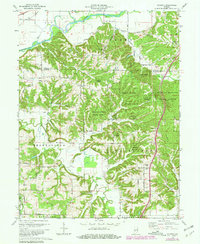
1970 Map of Modesto
USGS Topo · Published 1981About this map
Morgan-Monroe State Forest dominates this section of the Indiana uplands, where the boundary of Morgan Co Monroe Co cuts across a landscape of steep ridges and deep hollows. The northern reaches are defined by the White River and the Conrail rail line, which pass near the historic crossing at Paragon Bridge. To the south, the terrain transitions into the small settlement of Modesto, surrounded by a network of rural roads such as Old Indian Road and Bottom Road.
Find a feature on this map
52 named features on this map. Tap any name to fly to it.
Don’t see what you’re looking for? This feature index may not catch every label — zoom into the map to look around manually.
Map Details
Editions of this 1970 Modesto Map
3 editions found
Other maps of this area

1908 · Bloomington
USGS Topo · 1:48,000

1910 · Bloomington
USGS Topo · 1:62,500

1942 · Franklin
USGS Topo · 1:125,000

1947 · Unionville
USGS Topo · 1:24,000

1947 · Gosport
USGS Topo · 1:24,000

1948 · Hindustan
USGS Topo · 1:24,000

1949 · Quincy
USGS Topo · 1:24,000

1950 · Gosport
USGS Topo · 1:24,000

1953 · Indianapolis
USGS Topo · 1:250,000

1955 · Martinsville
USGS Topo · 1:24,000