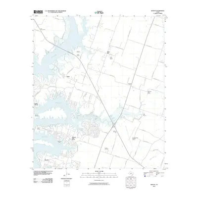
2010 Map of Moffat
USGS Topo · Published 2010About this map
Belton Lake dominates the western half of this Bell County landscape, its sprawling shoreline shaping the development of communities like Morgans Point Resort and Woodland. The 2010 topography shows a mix of suburban expansion and traditional rural landmarks, particularly in the northern reaches where the settlement of Moffat is flanked by the Moffat Cemetery and White Hall Cemetery. Further east, the terrain transitions into more industrial and transit-oriented uses, anchored by the Draughon-Miller Municipal Airport and the recreational Sunset Speedway. Local history is anchored by several long-standing burial grounds, including Saint Pauls Cemetery and Cedar Creek Cemetery, while the presence of Little Peach Airport and Charping Airport suggests a high density of private aviation in the area during this period. Notable natural features include Tweedle Mountain and the winding course of Kell Branch as it feeds into the lake.
Find a feature on this map
74 named features on this map. Tap any name to fly to it.
Don’t see what you’re looking for? This feature index may not catch every label — zoom into the map to look around manually.
Map Details
Editions of this 2010 Moffat Map
This is the sole edition of this map. No revisions or reprints were ever made.
Other maps of this area

1892 · Temple
USGS Topo · 1:125,000

1894 · Gatesville
USGS Topo · 1:125,000

1924 · Gatesville 4-d
USGS Topo · 1:48,000

1924 · Gatesville 4-a
USGS Topo · 1:48,000

1924 · Temple 2-C
USGS Topo · 1:48,000

1924 · Temple 3-C
USGS Topo · 1:48,000

1924 · Temple 3-B
USGS Topo · 1:48,000

1930 · Killeen
USGS Topo · 1:62,500

1931 · Mc Gregor
USGS Topo · 1:62,500

1931 · Belton
USGS Topo · 1:62,500