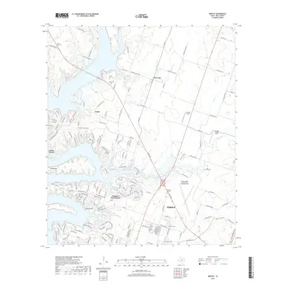
2019 Map of Moffat
USGS Topo · Published 2019About this map
Belton Lake dominates the western portion of this Central Texas landscape, where the meandering shoreline meets the residential expansion of Morgan's Point Resort. The area serves as a study in evolving land use, from the established rural community at Moffat to the industrial fringes of Temple in the southeast. This 2019 survey documents several generational landmarks, including the Saint Pauls Cem and White Hall Cem, which anchor the smaller hamlets of the region. The map also highlights the importance of aviation to the local infrastructure, showing the Draughon-Miller Central Texas Regional Airport alongside smaller airstrips like Charping Airport and Stampede Valley Airport. Distinctive terrain features such as Jubilee Springs and Tweedle Mtn offer a glimpse into the natural topography that surrounds these growing lakeside and agricultural settlements.
Find a feature on this map
163 named features on this map. Tap any name to fly to it.
Don’t see what you’re looking for? This feature index may not catch every label — zoom into the map to look around manually.
Map Details
Editions of this 2019 Moffat Map
This is the sole edition of this map. No revisions or reprints were ever made.
Other maps of this area

1892 · Temple
USGS Topo · 1:125,000

1894 · Gatesville
USGS Topo · 1:125,000

1924 · Gatesville 4-d
USGS Topo · 1:48,000

1924 · Gatesville 4-a
USGS Topo · 1:48,000

1924 · Temple 2-C
USGS Topo · 1:48,000

1924 · Temple 3-C
USGS Topo · 1:48,000

1924 · Temple 3-B
USGS Topo · 1:48,000

1930 · Killeen
USGS Topo · 1:62,500

1931 · Mc Gregor
USGS Topo · 1:62,500

1931 · Belton
USGS Topo · 1:62,500