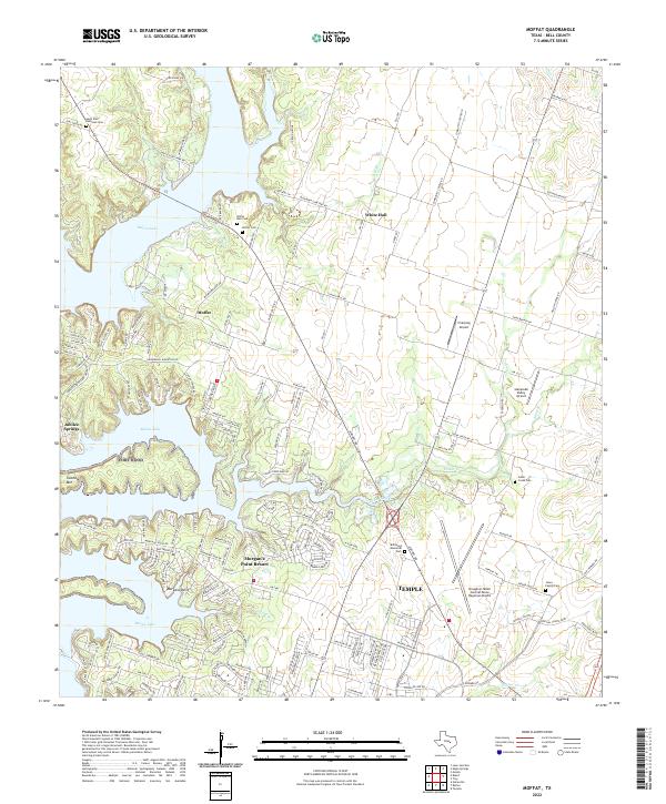
2022 Map of Moffat
USGS Topo · Published 2022About this map
Belton Lake dominates the western portion of this Bell County landscape, its sprawling shoreline shaping the modern residential developments of Morgan's Point Resort and Morgans Point. This contemporary survey reflects the transition of the area from rural agricultural land to suburban lakefront communities. Despite this growth, several deep-rooted historical landmarks remain preserved, including Saint Paul Lutheran Cem near White Hall and the Moffat Cem in the namesake community. To the southeast, the urban influence of Temple is visible as it extends toward the Draughon-Miller Central Texas Regional Airport. Small family burial sites such as the Jones Family Cem and Cedar Creek Cem stand as quiet reminders of the families who settled along the banks of Cedar Creek and Shine Br long before the waters of the lake were impounded.
Find a feature on this map
136 named features on this map. Tap any name to fly to it.
Don’t see what you’re looking for? This feature index may not catch every label — zoom into the map to look around manually.
Map Details
Editions of this 2022 Moffat Map
This is the sole edition of this map. No revisions or reprints were ever made.
Other maps of this area

1892 · Temple
USGS Topo · 1:125,000

1894 · Gatesville
USGS Topo · 1:125,000

1924 · Gatesville 4-d
USGS Topo · 1:48,000

1924 · Gatesville 4-a
USGS Topo · 1:48,000

1924 · Temple 2-C
USGS Topo · 1:48,000

1924 · Temple 3-C
USGS Topo · 1:48,000

1924 · Temple 3-B
USGS Topo · 1:48,000

1930 · Killeen
USGS Topo · 1:62,500

1931 · Mc Gregor
USGS Topo · 1:62,500

1931 · Belton
USGS Topo · 1:62,500