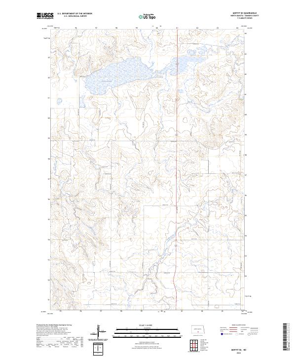
2024 Map of Moffit SE
USGS Topo · Published 2024About this map
Emmons County Waterfowl Production Area dominates the northern landscape of this prairie region, preserved for its vital role in the central flyway. The terrain is defined by a complex network of seasonal water bodies and drainage systems, most notably the expansive Dutton Slough which transitions into the surrounding wetlands. This 2024 survey illustrates the precision of modern section lines and township boundaries, including t136n r77w and t136n r76w, which dictate the grid of rural roads like 55th St SE and 5th Ave SE. Several drainages, including Hawk Creek, Badger Creek, and Long Lake Creek, carve subtle paths through the sections, reflecting the natural hydrology that still governs land use and conservation efforts in this part of the state.
Find a feature on this map
24 named features on this map. Tap any name to fly to it.
Don’t see what you’re looking for? This feature index may not catch every label — zoom into the map to look around manually.
Map Details
Editions of this 2024 Moffit SE Map
This is the sole edition of this map. No revisions or reprints were ever made.
Other maps of this area

1954 · Bismarck
USGS Topo · 1:250,000

1958 · Bismarck
USGS Topo · 1:250,000

1971 · Moffit SW
USGS Topo · 1:24,000

1971 · Hazelton
USGS Topo · 1:24,000

1971 · Moffit SE
USGS Topo · 1:24,000

1971 · Moffit NW
USGS Topo · 1:24,000
1971 · Hazelton NW
USGS Topo · 1:24,000

1971 · Moffit
USGS Topo · 1:24,000

1975 · Dana
USGS Topo · 1:24,000

1975 · Appert Lake
USGS Topo · 1:24,000