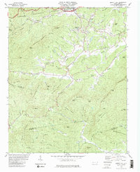
1982 Map of Moffitt Hill
USGS Topo · Published 1983About this map
The Catawba River and the tracks of the Southern RR dominate the northern landscape of this region, which includes portions of the Pisgah National Forest at the convergence of McDowell, Buncombe, and Rutherford counties. The settlement of Old Fort stands at the northern edge, serving as a gateway to the steep ridges that define the area, including Allison Ridge and Wildcat Knob. The map reveals a network of small mountain communities and rural centers such as Lackey Town, Moffitt Hill, and Davistown, which are supported by several local congregations like Bethlehem Ch and Salem Ch.
Find a feature on this map
78 named features on this map. Tap any name to fly to it.
Don’t see what you’re looking for? This feature index may not catch every label — zoom into the map to look around manually.
Map Details
Editions of this 1982 Moffitt Hill Map
2 editions found
Other maps of this area

1900 · Mount Mitchell
USGS Topo · 1:125,000

1902 · Mount Mitchell
USGS Topo · 1:125,000

1907 · Saluda
USGS Topo · 1:125,000

1934 · Parts Of Old Fort and Montreat
USGS Topo · 1:24,000

1935 · Montreat
USGS Topo · 1:24,000

1935 · Batcave
USGS Topo · 1:24,000

1935 · Black Mountain
USGS Topo · 1:24,000

1941 · Black Mountain
USGS Topo · 1:24,000
1942 · Montreat
USGS Topo · 1:24,000
1943 · Black Mountain
USGS Topo · 1:24,000