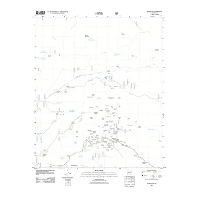
2011 Map of Mogollon
USGS Topo · Published 2011About this map
Mogollon sits at the heart of an intensive mineral exploration district, surrounded by a dense network of historic lode claims and tunnels. The settlement patterns follow the steep drainages of Mineral Creek and Silver Creek, where operations like the Enterprise Mine, Czar Mine, and Cooney Mine established the local economy. Evidence of the early community is preserved at the Mogollon Cemetery and the Cooney Cemetery near the site of Cooney.
Find a feature on this map
135 named features on this map. Tap any name to fly to it.
Don’t see what you’re looking for? This feature index may not catch every label — zoom into the map to look around manually.
Map Details
Editions of this 2011 Mogollon Map
This is the sole edition of this map. No revisions or reprints were ever made.
Other maps of this area

1910 · Mogollon
USGS Topo · 1:125,000

1912 · Mogollon
USGS Topo · 1:125,000

1915 · Reserve
USGS Topo · 1:125,000

1918 · Reserve
USGS Topo · 1:125,000

1954 · Clifton
USGS Topo · 1:250,000

1957 · Clifton
USGS Topo · 1:250,000

1958 · Clifton
USGS Topo · 1:250,000

1962 · Clifton
USGS Topo · 1:250,000

1963 · Bearwallow Mountain
USGS Topo · 1:24,000
1963 · Sign Camp Mountain
USGS Topo · 1:24,000