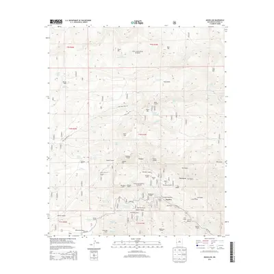
2013 Map of Mogollon
USGS Topo · Published 2013About this map
The mountain settlement of Mogollon sits deep within the Gila National Forest, surrounded by a landscape defined by steep canyons and historical mining-era landmarks. This area of Catron County is mapped with significant detail regarding local genealogy and history, including the Mogollon Cem and the more remote Cooney Cem near the site of Cooney. The terrain is characterized by dramatic elevation changes at Fannie Hill and Silver Peak, with the notable Needles Eye formation overlooking Mineral Cr. Further south, the broad Whitewater Mesa provides a contrast to the narrow corridors of Johnson Gulch and Graveyard Gulch. This survey records the proximity of early settlements like Claremont to the network of gulches and canyons that drove the region's early development, all accessed via the winding Bursum Rd.
Find a feature on this map
72 named features on this map. Tap any name to fly to it.
Don’t see what you’re looking for? This feature index may not catch every label — zoom into the map to look around manually.
Map Details
Editions of this 2013 Mogollon Map
This is the sole edition of this map. No revisions or reprints were ever made.
Other maps of this area

1910 · Mogollon
USGS Topo · 1:125,000

1912 · Mogollon
USGS Topo · 1:125,000

1915 · Reserve
USGS Topo · 1:125,000

1918 · Reserve
USGS Topo · 1:125,000

1954 · Clifton
USGS Topo · 1:250,000

1957 · Clifton
USGS Topo · 1:250,000

1958 · Clifton
USGS Topo · 1:250,000

1962 · Clifton
USGS Topo · 1:250,000

1963 · Bearwallow Mountain
USGS Topo · 1:24,000
1963 · Sign Camp Mountain
USGS Topo · 1:24,000