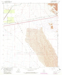
1965 Map of Mohawk
USGS Topo · Published 1982About this map
The Southern Pacific railroad corridor cuts across the desert landscape of this Arizona quadrangle, marking the primary artery of commerce through the Mohawk Valley. Near the settlement of Mohawk, the terrain transitions from the alluvial floor to the steep slopes of the Mohawk Mts, where Mohawk Pass provides a natural crossing. The presence of Ruins and Prospects near the mountains suggests early mining and settlement efforts in this arid environment, while a Pumping Station, Flume, and several Test Wells indicate the critical importance of water management and resource exploration during the mid-20th century. Extensive Sand Dunes dominate the southern portion of the sheet, falling within the boundaries of the Luke Air Force Range. This military designation contrasts with the civilian infrastructure of the north, including a remote Landing Strip and Gravel Pits located along the rail line.
Find a feature on this map
20 named features on this map. Tap any name to fly to it.
Don’t see what you’re looking for? This feature index may not catch every label — zoom into the map to look around manually.
Map Details
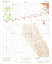
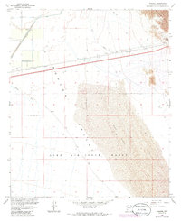
Editions of this 1965 Mohawk Map
3 editions found
Other maps of this area

1926 · Mohawk
USGS Topo · 1:62,500

1927 · Kim
USGS Topo · 1:62,500

1928 · Mohawk
USGS Topo · 1:62,500

1928 · Norton
USGS Topo · 1:62,500

1929 · Norton
USGS Topo · 1:62,500

1930 · Stoval
USGS Topo · 1:62,500

1931 · Kim
USGS Topo · 1:62,500

1950 · Stoval
USGS Topo · 1:62,500

1953 · Ajo
USGS Topo · 1:250,000

1955 · Growler
USGS Topo · 1:24,000