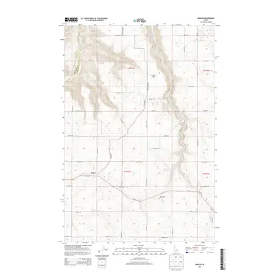
2013 Map of Mohler
USGS Topo · Published 2013About this map
Central Ridge dominates this northern Idaho landscape, dividing the watersheds of several deeply cut canyons. The settlements of Mohler and Howard serve as the primary hubs for this agricultural region, situated along the path of Id-64. The terrain is characterized by high plateaus deeply bisected by watercourses such as Big Canyon Cr and Little Canyon Cr, illustrating the erosion patterns typical of the Nez Perce and Lewis County borderlands. For those researching family history, the Russell Cem sits near the northern edge of the map, while a network of rural roads—many bearing local family names like Lauby Rd, Fletcher Rd, and Riggers Rd—connects the dispersed farmsteads across the ridge and into the surrounding draws like Long Hollow Cr.
Find a feature on this map
47 named features on this map. Tap any name to fly to it.
Don’t see what you’re looking for? This feature index may not catch every label — zoom into the map to look around manually.
Map Details
Editions of this 2013 Mohler Map
This is the sole edition of this map. No revisions or reprints were ever made.
Other maps of this area

1924 · Kamiah
USGS Topo · 1:125,000

1955 · Pullman
USGS Topo · 1:250,000

1958 · Pullman
USGS Topo · 1:250,000

1967 · Mohler
USGS Topo · 1:24,000

1967 · Fletcher
USGS Topo · 1:24,000

1967 · Craigmont
USGS Topo · 1:24,000

1967 · Sixmile Creek
USGS Topo · 1:24,000

1967 · Cottonwood NE
USGS Topo · 1:24,000

1967 · Peck
USGS Topo · 1:24,000

1967 · Orofino West
USGS Topo · 1:24,000