
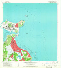
1959 Map of Mokapu
USGS Topo · Published 1960About this map
Kaneohe Marine Corps Air Station occupies the northern peninsula of the Mokapu quadrangle, illustrating the significant military footprint on Oahu just after statehood. This 1959 survey documents a landscape defined by the intersection of strategic defense and early suburban growth. Notable institutional sites include the Koolau Boys Home and Kawailoa Girls Home situated near the foot of the Olomana Ridge.
Find a feature on this map
55 named features on this map. Tap any name to fly to it.
Don’t see what you’re looking for? This feature index may not catch every label — zoom into the map to look around manually.
Map Details
Editions of this 1959 Mokapu Map
2 editions found
Other maps of this area

1952 · Koko Head
USGS Topo · 1:24,000

1952 · Mokapu
USGS Topo · 1:24,000

1953 · Honolulu
USGS Topo · 1:24,000

1954 · Oahu
USGS Topo · 1:250,000

1954 · Kahana
USGS Topo · 1:24,000

1954 · Kaneohe
USGS Topo · 1:24,000

1959 · Koko Head
USGS Topo · 1:24,000

1959 · Kaneohe
USGS Topo · 1:24,000

1959 · Honolulu
USGS Topo · 1:24,000

1961 · Oahu
USGS Topo · 1:250,000