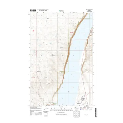
2014 Map of Mold
USGS Topo · Published 2014About this map
Banks Lake and the deep basalt depressions of the Grand Coulee dominate this landscape on the border of Douglas and Grant Counties. The small community of Mold sits in the northern uplands, marked by the nearby Mold Cem, while the southern reaches show the early 21st-century footprint of Coulee City and the neighboring residential area at Banks Lake South.
Find a feature on this map
39 named features on this map. Tap any name to fly to it.
Don’t see what you’re looking for? This feature index may not catch every label — zoom into the map to look around manually.
Map Details
Editions of this 2014 Mold Map
This is the sole edition of this map. No revisions or reprints were ever made.
Other maps of this area

1930 · Grand Coulee Sheet 3
USGS Topo · 1:31,680

1953 · Ritzville
USGS Topo · 1:250,000

1959 · Ritzville
USGS Topo · 1:250,000

1965 · Ritzville
USGS Topo · 1:250,000

1965 · St. Andrews
USGS Topo · 1:24,000

1965 · Mold
USGS Topo · 1:24,000
1965 · Park Lake
USGS Topo · 1:24,000

1965 · Coulee City
USGS Topo · 1:24,000

1968 · Steamboat Rock SW
USGS Topo · 1:24,000

1968 · Hartline SW
USGS Topo · 1:24,000