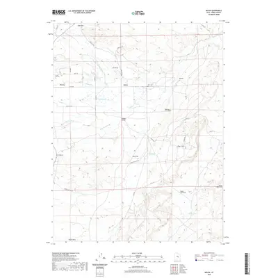
2020 Map of Molen
USGS Topo · Published 2020About this map
Castle Valley and the surrounding high desert of Emery County are defined by an intricate network of irrigation systems and topographical landmarks. The landscape is carved by the Ferron Creek and marked by the distinct Ferron Reef formation. In this agricultural corridor, the reliance on water management is evident through the many engineered waterways like Molen Ditch, Fugate Ditch, and the Peterson Ditch. These ditches support the small communities of Ferron, Clawson, and Molen. Local history is anchored at the Ferron City Cemetery and Molen Cemetery, while the terrain transitions into complex drainages such as Shearing Corral Draw and Yellow Seep Wash. From the elevations of Kings Crown to the expanse of Dutch Flat, this map documents the persistent human efforts to utilize the arid desert floor.
Find a feature on this map
35 named features on this map. Tap any name to fly to it.
Don’t see what you’re looking for? This feature index may not catch every label — zoom into the map to look around manually.
Map Details
Editions of this 2020 Molen Map
This is the sole edition of this map. No revisions or reprints were ever made.
Other maps of this area

1885 · San Rafael
USGS Topo · 1:250,000

1885 · Manti
USGS Topo · 1:250,000

1885 · Fish Lake
USGS Topo · 1:250,000

1886 · Price River
USGS Topo · 1:250,000

1895 · Manti
USGS Topo · 1:250,000

1896 · Price River
USGS Topo · 1:250,000

1896 · Fish Lake
USGS Topo · 1:250,000

1923 · Castle Dale
USGS Topo · 1:62,500

1925 · Castle Dale
USGS Topo · 1:62,500

1952 · San Rafael Knob
USGS Topo · 1:62,500