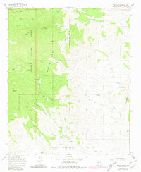
1965 Map of Molino Peak
USGS Topo · Published 1981About this map
Magdalena Mountains and the Cibola National Forest dominate this mid-century landscape, revealing a rugged high-desert terrain defined by deep canyons and scattered water sources. The map highlights the essential role of water management in this arid environment, marked by sites such as Upper Tank, Gay Water Tank, and Broken Tank. Remote outposts like Gianero Ranch represent the sparse human presence, while numerous labels for Prospects and Strip Mine point toward a history of mineral exploration in the canyons.
Find a feature on this map
37 named features on this map. Tap any name to fly to it.
Don’t see what you’re looking for? This feature index may not catch every label — zoom into the map to look around manually.
Map Details
Editions of this 1965 Molino Peak Map
2 editions found
Other maps of this area

1906 · Socorro
USGS Topo · 1:62,500

1916 · La Joya
USGS Topo · 1:125,000

1948 · San Antonio
USGS Topo · 1:62,500

1954 · Tularosa
USGS Topo · 1:250,000

1954 · Socorro
USGS Topo · 1:250,000

1958 · Socorro
USGS Topo · 1:250,000

1958 · Tularosa
USGS Topo · 1:250,000

1959 · Socorro
USGS Topo · 1:24,000

1959 · Magdalena
USGS Topo · 1:62,500

1959 · Socorro
USGS Topo · 1:62,500