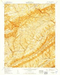
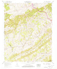
1958 Map of Moll Creek
USGS Topo · Published 1960About this map
Banners Corner and the surrounding mountain ridges define the landscape of Russell County in the late 1950s. The terrain is marked by the parallel rises of Chestnut Ridge, Copper Ridge, and Moccasin Ridge, with Clinch Mountain forming a massive barrier to the south. Between these heights, deep valleys such as Moccasin Valley and numerous hollows like Osborne Hollow and Meade Hollow harbor a dense network of family-named cemeteries and rural institutions.
Find a feature on this map
92 named features on this map. Tap any name to fly to it.
Don’t see what you’re looking for? This feature index may not catch every label — zoom into the map to look around manually.
Map Details
Editions of this 1958 Moll Creek Map
5 editions found
Other maps of this area

1897 · Bristol
USGS Topo · 1:125,000

1902 · Bristol
USGS Topo · 1:125,000

1918 · Carterton
USGS Topo · 1:62,500

1920 · Coeburn
USGS Topo · 1:48,000

1934 · Wallace
USGS Topo · 1:24,000

1934 · Hansonville
USGS Topo · 1:24,000
1934 · Carbo
USGS Topo · 1:24,000

1935 · Hilton
USGS Topo · 1:24,000

1935 · Mendota
USGS Topo · 1:24,000
1935 · Moll Creek
USGS Topo · 1:24,000