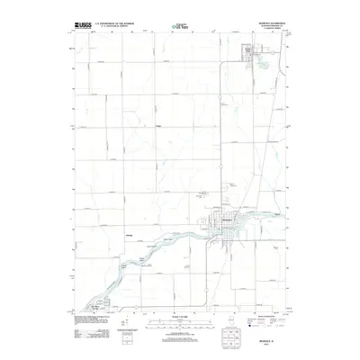
2012 Map of Momence
USGS Topo · Published 2012About this map
The Kankakee River winds through the heart of this landscape, defining a series of significant landforms including Parish Island, Koops Island, and Eagle Island. This 2012 survey illustrates the river-centric geography of Momence, where the water transitions past the South Shore Golf Course and into the broader marshy terrain of Kankakee County. To the north, the village of Grant Park sits near Lake Metonga, marking a transition toward the agricultural plains that dominate the upper half of the quadrangle.
Find a feature on this map
97 named features on this map. Tap any name to fly to it.
Don’t see what you’re looking for? This feature index may not catch every label — zoom into the map to look around manually.
Map Details
Editions of this 2012 Momence Map
This is the sole edition of this map. No revisions or reprints were ever made.
Other maps of this area

1922 · Momence
USGS Topo · 1:62,500

1922 · Kankakee
USGS Topo · 1:62,500

1924 · Momence
USGS Topo · 1:62,500

1924 · Kankakee
USGS Topo · 1:62,500

1949 · Peotone
USGS Topo · 1:62,500

1949 · Crete
USGS Topo · 1:62,500

1953 · Beecher West
USGS Topo · 1:24,000

1953 · Beecher East
USGS Topo · 1:24,000

1953 · Peotone
USGS Topo · 1:24,000

1953 · Chicago
USGS Topo · 1:250,000