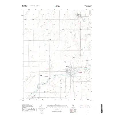
2018 Map of Momence
USGS Topo · Published 2018About this map
The Kankakee River winds through the heart of this landscape, defining the character of eastern Illinois as it creates a series of substantial river islands including Parish Island, Koops Island, and Maple Island. The city of Momence serves as the primary hub, where the river's path is flanked by residential blocks and cemeteries such as Saint Patricks Cem and Momence Cem. North of the river, the terrain shifts into a precise grid of agricultural roads, interrupted by smaller settlements like Grant Park and Yeager. Local history is preserved in several rural burial grounds, including Union Corner Cem and Shrontz Cem, while the eastern portion of the sheet features the recreational waters of Lake Metonga and Mirror Lake. The area's transport network is a mix of traditional county highways and a significant north-south railroad corridor, reflecting the region's enduring connection between river-based geography and rail-bound commerce.
Find a feature on this map
69 named features on this map. Tap any name to fly to it.
Don’t see what you’re looking for? This feature index may not catch every label — zoom into the map to look around manually.
Map Details
Editions of this 2018 Momence Map
This is the sole edition of this map. No revisions or reprints were ever made.
Other maps of this area

1922 · Momence
USGS Topo · 1:62,500

1922 · Kankakee
USGS Topo · 1:62,500

1924 · Momence
USGS Topo · 1:62,500

1924 · Kankakee
USGS Topo · 1:62,500

1949 · Peotone
USGS Topo · 1:62,500

1949 · Crete
USGS Topo · 1:62,500

1953 · Beecher West
USGS Topo · 1:24,000

1953 · Beecher East
USGS Topo · 1:24,000

1953 · Peotone
USGS Topo · 1:24,000

1953 · Chicago
USGS Topo · 1:250,000