2024 Map of Momence
USGS Topo · Published 2024About this map
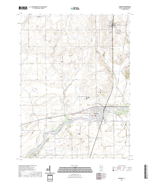
The Kankakee River dominates this portion of Kankakee County, carving a complex path through the landscape that creates a series of named landforms including Parish Island, Koops Island, and Maple Island. The city of Momence serves as the primary hub, where a dense street grid meets the riverbanks near Mirror Lake. To the north, the terrain transitions into a highly organized agricultural grid, punctuated by small settlements like Whitaker and Yeager. Local history and genealogy are well-represented by several established burial grounds, such as Saint Patricks Cem and the Union Corners Cem. The map also captures specialized land use, such as the Farm Service Agency Interest of Illinois near Grant Park, while waterways like Tower Creek and Trim Creek feed into the larger river system from the surrounding prairies.
Find a feature on this map
64 named features on this map. Tap any name to fly to it.
Don’t see what you’re looking for? This feature index may not catch every label — zoom into the map to look around manually.
Map Details
Editions of this 2024 Momence Map
This is the sole edition of this map. No revisions or reprints were ever made.
Historical Maps of Yeager Through Time
4 maps found