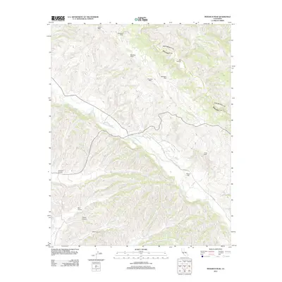
2012 Map of Monarch Peak
USGS Topo · Published 2012About this map
San Lorenzo Cr defines the central drainage of this landscape in the southern Diablo Range, winding through a terrain dominated by significant elevations and named peaks. The map details the prominence of Monarch Peak and the nearby Mustang Ridge, alongside distinct geological features such as Banchero Rock and Cleveland Rock. This area, characterized by its drainages and ridges, shows a network of canyons including Griswold Canyon, Blair Canyon, and Tickner Canyon that cut through the high ground. Human activity is represented by the path of Peach Tree Rd and Pine Valley Rd, providing access to this interior coastal range. The cartography illustrates a transition from the lower elevations of Cow Cr and Lewis Cr to the heights of Austin Peak and Chalk Peak, mapping the drainage patterns essential to the local watershed.
Find a feature on this map
18 named features on this map. Tap any name to fly to it.
Don’t see what you’re looking for? This feature index may not catch every label — zoom into the map to look around manually.
Map Details
Editions of this 2012 Monarch Peak Map
This is the sole edition of this map. No revisions or reprints were ever made.
Other maps of this area

1912 · San Ardo
USGS Topo · 1:31,680

1915 · Priest Valley
USGS Topo · 1:125,000

1941 · Priest Valley
USGS Topo · 1:62,500

1941 · San Ardo
USGS Topo · 1:62,500

1943 · New Idria
USGS Topo · 1:62,500

1943 · San Ardo
USGS Topo · 1:62,500

1943 · Hernandez Valley
USGS Topo · 1:62,500

1944 · Hernandez Valley
USGS Topo · 1:62,500

1944 · Priest Valley
USGS Topo · 1:62,500

1948 · Santa Cruz
USGS Topo · 1:250,000