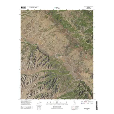
2015 Map of Monarch Peak
USGS Topo · Published 2015About this map
The San Andreas Fault cuts a visible path through this portion of the Diablo Range, defining the tectonic character of the landscape where Monterey and San Benito counties meet. High points such as Monarch Peak and Mustang Ridge dominate the northern terrain, while the low-lying Peachtree Valley provides a corridor for travel and settlement in the southeast. This region is marked by a complex system of drainage, with the San Lorenzo Cr and its tributaries, including Cow Cr and Lewis Cr, carving deep paths through the hills. Transportation is concentrated along Peach Tree Rd, which follows the natural contours of the valleys. Numerous named features like Banchero Rock, Cleveland Rock, and Negro Hill offer specific landmarks for those studying the geology or local history of this sparsely populated section of the California Coast Ranges.
Find a feature on this map
32 named features on this map. Tap any name to fly to it.
Don’t see what you’re looking for? This feature index may not catch every label — zoom into the map to look around manually.
Map Details
Editions of this 2015 Monarch Peak Map
This is the sole edition of this map. No revisions or reprints were ever made.
Other maps of this area

1912 · San Ardo
USGS Topo · 1:31,680

1915 · Priest Valley
USGS Topo · 1:125,000

1941 · Priest Valley
USGS Topo · 1:62,500

1941 · San Ardo
USGS Topo · 1:62,500

1943 · New Idria
USGS Topo · 1:62,500

1943 · San Ardo
USGS Topo · 1:62,500

1943 · Hernandez Valley
USGS Topo · 1:62,500

1944 · Hernandez Valley
USGS Topo · 1:62,500

1944 · Priest Valley
USGS Topo · 1:62,500

1948 · Santa Cruz
USGS Topo · 1:250,000