2024 Map of Moncks Corner
USGS Topo · Published 2024About this map
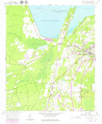
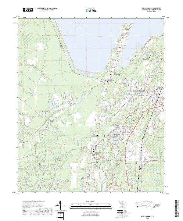
Pinopolis Peninsula extends into the southern waters of Lake Moultrie, anchoring a landscape defined by its proximity to the massive Santee Cooper Power and Navigation Project reservoir. The area around Moncks Corner serves as a transitional zone between the modern water management infrastructure and the deeply rooted rural communities of Berkeley County. A high density of burial grounds, such as Saint Johns Church Graveyard and Old Nazareth Cem, speaks to a long-established social fabric in settlements like Wampee and Pinopolis. The southeastern portion of the map is dominated by the dense wetlands of Ellory Swamp, while the Berkeley County Airport and highway corridors toward Whitesville reflect the contemporary growth of the region. Local hydrology, including Molly Branch and Stony Branch, continues to shape the low-lying terrain near the historic Oakley station area.
Find a feature on this map
166 named features on this map. Tap any name to fly to it.
Don’t see what you’re looking for? This feature index may not catch every label — zoom into the map to look around manually.
Map Details
Editions of this 2024 Moncks Corner Map
This is the sole edition of this map. No revisions or reprints were ever made.