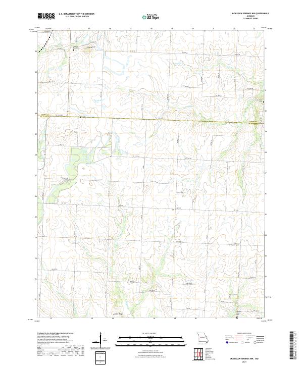
2021 Map of Monegaw Springs NW
USGS Topo · Published 2021About this map
The Mound rises as a distinct landmark in the northern reaches of this rural landscape, which spans the boundary between Henry and St. Clair Counties. The area is defined by a dense network of local routes, including NW 1270 RD and State Hwy AA, connecting scattered homesites and agricultural land. Several historical burial grounds are preserved across the terrain, notably the Montrose Mound Cem near the northern border and Teas Chapel Cem to the east. Waterways like Ricky Cr, Marshall Cr, and Bear Cr drain the undulating hills, while the small settlement of Golden Ridge anchors the southern portion of the survey. This 2021 update documents the enduring rural structure of the region, showing how contemporary road designations overlay the traditional settlement patterns and family-named cemeteries of western Missouri.
Find a feature on this map
32 named features on this map. Tap any name to fly to it.
Don’t see what you’re looking for? This feature index may not catch every label — zoom into the map to look around manually.
Map Details
Editions of this 2021 Monegaw Springs NW Map
This is the sole edition of this map. No revisions or reprints were ever made.
Other maps of this area

1887 · Clinton
USGS Topo · 1:125,000

1887 · Butler
USGS Topo · 1:125,000

1894 · Butler
USGS Topo · 1:125,000

1894 · Clinton
USGS Topo · 1:125,000

1934 · Rockville
USGS Topo · 1:24,000

1938 · Monegaw Springs
USGS Topo · 1:24,000

1938 · Taberville
USGS Topo · 1:24,000

1940 · Taberville
USGS Topo · 1:24,000
1940 · Monegaw Springs
USGS Topo · 1:24,000

1947 · Jefferson City
USGS Topo · 1:250,000