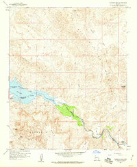
1959 Map of Monkeys Head
USGS Topo · Published 1960About this map
Bill Williams River carves through a landscape of sharp ridges and desert washes along the border of Mohave and Yuma counties during the late 1950s. The topography is dominated by the Buckskin Mountains and the Aubrey Hills, which overlook the eastern reaches of Havasu Lake. This survey captures the region just as the Havasu Lake National Wildlife Refuge was establishing its presence across the riparian corridor and shoreline. Remote outposts like the Kohen Ranch and Ramon Esquerra Ranch mark the few signs of permanent human habitation in this arid terrain, with the latter featuring a small Cem nearby. Evidence of desert exploration and mining is visible at the Paloma Prospect, while navigation through the backcountry relied on a network of Jeep Trails connecting various water sources like Havasu Spring and Goat Spring.
Find a feature on this map
26 named features on this map. Tap any name to fly to it.
Don’t see what you’re looking for? This feature index may not catch every label — zoom into the map to look around manually.
Map Details
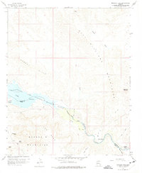
Editions of this 1959 Monkeys Head Map
2 editions found
Other maps of this area

1911 · Parker
USGS Topo · 1:125,000

1923 · Signal
USGS Topo · 1:250,000

1942 · Signal
USGS Topo · 1:250,000

1943 · Giers Basin
USGS Topo · 1:62,500

1950 · Parker Dam Area
USGS Topo · 1:62,500

1950 · Prescott
USGS Topo · 1:250,000

1954 · Needles
USGS Topo · 1:250,000

1954 · Prescott
USGS Topo · 1:250,000

1956 · Needles
USGS Topo · 1:250,000

1958 · Prescott
USGS Topo · 1:250,000