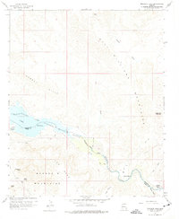
1959 Map of Monkeys Head
USGS Topo · Published 1975About this map
Bill Williams River meanders through the desert landscape of the Mohave Co Yuma Co border, providing a critical water source for the isolated homesteads and wildlife of this arid region. The mid-century environment is defined by the expanse of Havasu Lake and the Havasu National Wildlife Refuge, where the river meets the reservoir. Ranching life is documented through established sites like Kohen Ranch and the Ramon Esquerra Ranch near the mouth of Mineral Wash, with a small Cem nearby suggesting a permanent family presence on the land.
Find a feature on this map
27 named features on this map. Tap any name to fly to it.
Don’t see what you’re looking for? This feature index may not catch every label — zoom into the map to look around manually.
Map Details
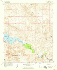
Editions of this 1959 Monkeys Head Map
2 editions found
Other maps of this area

1911 · Parker
USGS Topo · 1:125,000

1923 · Signal
USGS Topo · 1:250,000

1942 · Signal
USGS Topo · 1:250,000

1943 · Giers Basin
USGS Topo · 1:62,500

1950 · Parker Dam Area
USGS Topo · 1:62,500

1950 · Prescott
USGS Topo · 1:250,000

1954 · Needles
USGS Topo · 1:250,000

1954 · Prescott
USGS Topo · 1:250,000

1956 · Needles
USGS Topo · 1:250,000

1958 · Prescott
USGS Topo · 1:250,000