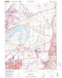
1998 Map of Monks Mound
USGS Topo · Published 1999About this map
Cahokia Mounds State Historic Site dominates the central landscape of this Madison and St. Clair County border region, featuring world-renowned archaeological landmarks like Monks Mound and Rattlesnake Mound. The industrial and residential growth of Granite City and East St. Louis press against the oxbow waters of Horseshoe Lake, illustrating the tension between preservation and urban expansion in the late 20th century.
Find a feature on this map
56 named features on this map. Tap any name to fly to it.
Don’t see what you’re looking for? This feature index may not catch every label — zoom into the map to look around manually.
Map Details
Editions of this 1998 Monks Mound Map
This is the sole edition of this map. No revisions or reprints were ever made.
Other maps of this area

1888 · St. Louis
USGS Topo · 1:62,500

1907 · Belleville
USGS Topo · 1:62,500

1927 · Alton
USGS Topo · 1:62,500

1927 · Edwardsville
USGS Topo · 1:62,500

1931 · French Village
USGS Topo · 1:24,000

1932 · Edwardsville
USGS Topo · 1:62,500

1933 · Granite City
USGS Topo · 1:24,000

1933 · Cahokia
USGS Topo · 1:24,000

1934 · Cahokia
USGS Topo · 1:24,000

1934 · Alton
USGS Topo · 1:62,500