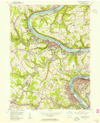
1954 Map of Monongahela
USGS Topo · Published 1955About this map
The Monongahela River anchors this mid-century portrait of Pennsylvania industrial life, where coal extraction and river transit define the landscape. Extensive operations like the Mathies Mine and Bunola Mine are depicted alongside their associated mine dumps and infrastructure. The map reveals the high density of the river valley, from the established streets of Monongahela to the northern borough of North Charleroi. Settlement patterns follow the bends of the river and the tracks of the Pittsburgh and Lake Erie and Donora Southern railroads.
Find a feature on this map
122 named features on this map. Tap any name to fly to it.
Don’t see what you’re looking for? This feature index may not catch every label — zoom into the map to look around manually.
Map Details
Editions of this 1954 Monongahela Map
4 editions found
Other maps of this area

1901 · Amity
USGS Topo · 1:62,500

1902 · Brownsville
USGS Topo · 1:62,500

1904 · Amity
USGS Topo · 1:62,500

1904 · Mc Keesport
USGS Topo · 1:62,500

1904 · Carnegie
USGS Topo · 1:62,500

1906 · Brownsville
USGS Topo · 1:62,500

1906 · Carnegie
USGS Topo · 1:62,500

1907 · Pittsburg
USGS Topo · 1:62,500

1908 · Carnegie
USGS Topo · 1:62,500

1931 · Brownsville
USGS Topo · 1:62,500