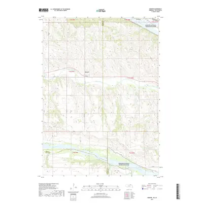
2017 Map of Monowi
USGS Topo · Published 2017About this map
Monowi sits near the center of this landscape, a place well-known in the twenty-first century for its unique status as one of the smallest incorporated municipalities in the United States. The topography is defined by the convergence of major waterways, with the Missouri River forming the northeastern boundary and the Niobrara River cutting through the southern portion of the quadrangle. These river valleys are protected under the Missouri National Recreation River designation, highlighting the importance of the riparian corridor in Boyd and Knox counties.
Find a feature on this map
27 named features on this map. Tap any name to fly to it.
Don’t see what you’re looking for? This feature index may not catch every label — zoom into the map to look around manually.
Map Details
Editions of this 2017 Monowi Map
This is the sole edition of this map. No revisions or reprints were ever made.
Other maps of this area

1950 · Verdel
USGS Topo · 1:24,000

1950 · Dorsey NW
USGS Topo · 1:24,000

1950 · Lynch
USGS Topo · 1:24,000

1950 · Pishelville
USGS Topo · 1:24,000

1950 · Monowi
USGS Topo · 1:24,000

1952 · Monowi
USGS Topo · 1:24,000

1952 · Dorsey
USGS Topo · 1:24,000

1955 · O'Neill
USGS Topo · 1:250,000

1959 · O'Neill
USGS Topo · 1:250,000

1964 · Lynch NE
USGS Topo · 1:24,000